A man i met here in DC.........would call that...........a weapon of mass distraction...........the media..........orange barrel or otherwise..............tends to focus on the flasher event..........a plane hitting a bridge is fairly flashy.......................and the 14th bridge at that.......which is the continutaion of I 395 north from Va into Dc............then u can take a freeway to get to SE..........RFK.......Nationals park.....or veer left..........to downtown DC..........
Not only all that............but they had a storm of the century going
on at the same time..............a local
snowstorm........................
Between
the effects of the storm, and the rescue efforts around the 14th Street
(I-395/US-1) bridges, the 12-lane complex ceased to function, and
closed to traffic. The George Washington Parkway, which parallels the
Potomac River in Virginia, also closed near the crash site.
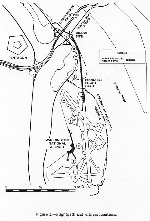
| |  | Map showing airport and flightpath, from NTSB accident report. Click for larger photo images: Medium (31K), Large (59K). |
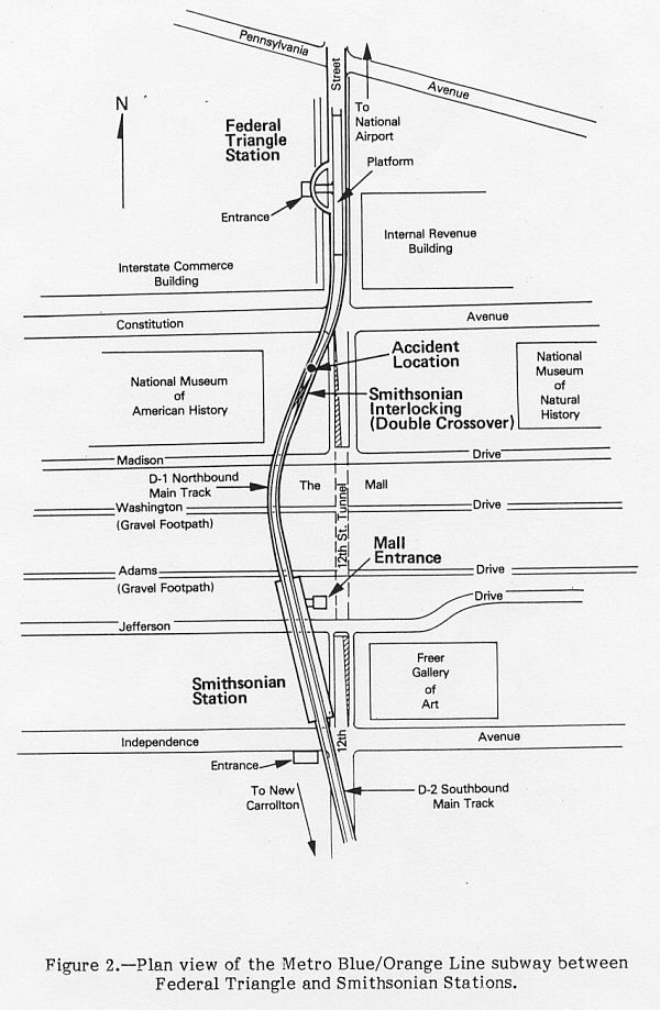
A rapid rail transit accident occurred about one half hour after the air crash. At 4:30 PM, one car of a WMATA Metrorail
train derailed while the train was being backed up through a crossover
switch south of the Federal Triangle Station in D.C., and the car was
pulled sideways and it crashed into the concrete pillar separating the
inbound and outbound subway tunnels. A misaligned switch at Smithsonian
Interlocking caused the rear wheel truck to derail, and the wheels
tracked alongside of the rails for 171 feet, following the opposite
track, until the car impacted the concrete pillar. There were 3
fatalities, and 25 injuries. Investigations identified human operational
error as the primary cause.
This
occurred on the Blue/Orange Line, and resulted in the both lines being
shut down. At that time, the Blue Line ran from National Airport Station
in Arlington to Addison Road Station in Maryland, and the Orange Line
ran from Ballston Station in Arlington to New Carrolton Station in
Maryland. The derailment occurred on the section where the two lines
share the same cross-town subway route, and the wrecked subway car
blocked both tracks. The other (then) open line, the Red Line, was not
affected.
| | 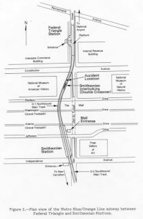 | Map showing Metrorail accident location, from NTSB accident report. Click for larger photo image: Large (84K). |
No comments:
Post a Comment