Geography[edit]
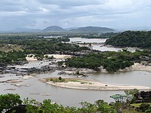
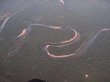
The course of the Orinoco forms a wide ellipsoidal arc, surrounding the Guiana Shield; it is divided in four stretches of unequal length that roughly correspond to the longitudinal zonation of a typical large river:
- Upper Orinoco— 242 kilometres (150 mi) long, from its headwaters to the rapids Raudales de Guaharibos, flows through mountainous landscape in a northwesterly direction
- Middle Orinoco— 750 kilometres (470 mi) long, divided into two sectors, the first of which ca. 480 kilometres (300 mi) long has a general westward direction down to the confluence with the Atabapo andGuaviare rivers at San Fernando de Atabapo; the second flows northward, for about 270 kilometres (170 mi), along the Venezuelan - Colombian border, flanked on both sides by the westernmost granitic upwellings of the Guiana Shield which impede the development of a flood plain, to the Atures rapids near the confluence with the Meta River at Puerto Carreño,
- Lower Orinoco— 959 kilometres (596 mi) long with a well-developed alluvial plain, flows in a northeast direction, from Atures rapids down to Piacoa in front of Barrancas
- Delta Amacuro— 200 kilometres (120 mi) long that empties into the Gulf of Paría and the Atlantic Ocean, a very large delta, some 22,500 km2 (8,700 sq mi) and 370 kilometres (230 mi) at its widest.
At its mouth, the Orinoco forms a wide delta that branches off into hundreds of rivers and waterways that flow through 41,000 km2 (16,000 sq mi) of swampy forests. In the rainy season, the Orinoco can swell to a breadth of 22 kilometres (14 mi) and a depth of 100 metres (330 ft).
Most of the important Venezuelan rivers are tributaries of the Orinoco, the largest being the Caroní, which joins it at Puerto Ordaz, close to the Llovizna Falls. A peculiarity of the Orinoco river system is the Casiquiare canal, which starts as an arm of the Orinoco, and finds its way to the Rio Negro, a tributary of the Amazon, thus forming a 'natural canal' between Orinoco and Amazon.
Major rivers in the Orinoco Basin[edit]
- Apure: from Venezuela through the east into the Orinoco
- Arauca: from Colombia to Venezuela east into the Orinoco
- Atabapo: from the Guiana Highlands of Venezuela north into the Orinoco
- Caroní: from the Guiana Highlands of Venezuela north into the Orinoco
- Casiquiare canal: in SE Venezuela, a distributary from the Orinoco flowing west to the Negro River, a major affluent to the Amazon
- Caura: from eastern Venezuela (Guiana Highlands) north into the Orinoco
- Guaviare: from Colombia east into the Orinoco
- Inírida: from Colombia southeast into the Guaviare.
- Meta: from Colombia, border with Venezuela east into the Orinoco
- Ventuari: from eastern Venezuela (the Guiana Highlands) southwest into the Orinoco
- Vichada: from Colombia east into the Orinoco
See also: Casiquiare canal-Orinoco Riv


No comments:
Post a Comment