Tuesday, September 29, 2015

St pet............to Leningrad...........back to St. Pet................................a function of the sea.............a city in Florida bearing the name of Russia's 2nd biggest city..........also a port.......on the Baltic.......which is a bit colder than the Gulf of Mexico.............
\


Saint Petersburg

From Wikipedia, the free encyclopedia
"Leningrad" redirects here. For other uses, see Leningrad (disambiguation).
This article is about the city in Russia. For the city in the U.S. state of Florida, see St. Petersburg, Florida. For other uses, see Saint Petersburg (disambiguation).
Saint Petersburg
Санкт-Петербург (Russian)
—  Federal city  —

Top left to bottom right: Peter and Paul Fortress on Zayachy Island,Smolny CathedralMoyka river with the General Staff Building,Trinity CathedralBronze Horseman on Senate Square, and theWinter Palace.

Flag

Coat of arms
Coordinates: 59°57′N 30°18′ECoordinates59°57′N 30°18′E
Political status
CountryRussia
Federal districtNorthwestern[1]
Economic regionNorthwestern[2]
EstablishedMay 27, 1703[3]
Federal city DayMay 27[4]
Government (as of March 2010)
 • GovernorGeorgy Poltavchenko
 • LegislatureLegislative Assembly
Statistics
Area [5]
 • Total1,439 km2 (556 sq mi)
Area rank82nd
Population (2010 Census)[6]
 • Total4,879,566
 • Rank4th
 • Density[7]3,390.94/km2 (8,782.5/sq mi)
 • Urban100%
 • Rural0%
Population (2015 est.)
 • Total5,191,690[8]
Time zone(s)MSK (UTC+03:00)[9]
ISO 3166-2RU-SPE
License plates78, 98, 178
Official languagesRussian[10]
Official website
Saint Petersburg (RussianСанкт-Петербу́ргtr. Sankt-PeterburgIPA: [ˈsankt pʲɪtʲɪrˈburk]) is the second largest city in Russia, politically incorporated as a federal subject (a federal city). It is located on the Neva River at the head of the Gulf of Finland on the Baltic Sea. In 1914 the name of the city was changed from Saint Petersburg to Petrograd (RussianПетроградIPA: [pʲɪtrɐˈgrat]), in 1924 to Leningrad (RussianЛенинградIPA: [lʲɪnʲɪnˈgrat]), and in 1991, back to Saint Petersburg.
In Russian literature, informal documents, and discourse, the word "Saint" (RussianСанкт) is usually omitted, leaving "Petersburg" (RussianПетербург). In casual conversation Russians may drop the "burg" (Russianбург) as well, referring to it as "Piter" (RussianПитер).
Saint Petersburg was founded by Tsar Peter the Great on May 27 [O.S. 16] 1703. Between 1713–1728 and 1732–1918, Saint Petersburg was the imperial capital of Russia. In 1918, the central government bodies moved from Saint Petersburg (then named Petrograd) to Moscow.[11] It is Russia's 2nd largest cityafter Moscow with 5 million inhabitants (2012) and the fourth most populated federal subject.[6] Saint Petersburg is a major European cultural center, and also an important Russian port on the Baltic Sea.
Saint Petersburg is often described as the most Westernized city of Russia, as well as its cultural capital.[12] It is the northernmost city in the world with a population of over one million.[13] The Historic Centre of Saint Petersburg and Related Groups of Monuments constitute a UNESCO World Heritage Site. Saint Petersburg is also home to The Hermitage, one of the largest art museums in the world.[14] A large number of foreign consulatesinternational corporations, banks, and other businesses are located in Saint Petersburg.

History[edit]

Before 1900[edit]

Swedish colonists built Nyenskans, a fortress, at the mouth of the Neva River in 1611, in a land then called Ingermanland, that was inhabited by Finnic tribe ofIngrians.[15] A small town called "Nyen" grew up around it.
Peter the Great was interested in seafaring and maritime affairs, and he intended to have Russia gain a seaport in order to be able to trade with other maritime nations.[16] He needed a better seaport than Arkhangelsk, which was on the White Sea to the north and closed to shipping for months during the winter.
The Bronze Horseman, monument to Peter the Great
On May 12 [O.S. 1] 1703, during the Great Northern WarPeter the Great captured Nyenskans, and soon replaced the fortress. On May 27 [O.S. 16] 1703,[17] closer to the estuary 5 km (3 mi) inland from the gulf), on Zayachy (Hare) Island, he laid down thePeter and Paul Fortress, which became the first brick and stone building of the new city.[18]
The city was built by conscripted peasants from all over Russia; a number of Swedish prisoners of war were also involved in some years[19] under the supervision of Alexander Menshikov. Tens of thousands of serfs died building the city.[20] Later, the city became the centre of the Saint Petersburg Governorate. Peter moved the capital from Moscow to Saint Petersburg in 1712, 9 years before the Treaty of Nystad of 1721 ended the war; he referred to Saint Petersburg as the capital (or seat of government) as early as 1704.[16]
During its first few years, the city developed around Trinity Square on the right bank of the Neva, near the Peter and Paul Fortress. However, Saint Petersburg soon started to be built out according to a plan. By 1716 Domenico Trezzini had elaborated a project whereby the city centre would be located on Vasilyevsky Island and shaped by a rectangular grid of canals. The project was not completed, and is evident in the layout of the streets. In 1716, Peter the Great appointed Jean-Baptiste Alexandre Le Blond as the chief architect of Saint Petersburg.
The style of Petrine Baroque, developed by Trezzini and other architects and exemplified by such buildings as the Menshikov PalaceKunstkameraPeter and Paul CathedralTwelve Collegia, became prominent in the city architecture of the early 18th century. In 1724 the Academy of SciencesUniversity and Academic Gymnasium were established in Saint Petersburg by Peter the Great.
In 1725, Peter died at the age of fifty-two. His endeavours to modernize Russia had met with opposition from the Russian nobility—resulting in several attempts on his life and a treason case involving his son.[21] In 1728, Peter II of Russia moved his seat back to Moscow. But four years later, in 1732, under Empress Anna of Russia, Saint Petersburg was again designated as the capital of the Russian Empire. It remained the seat of the Romanov dynasty and the Imperial Court of the Russian Tsars, as well as the seat of the Russian government, for another 186 years until the communist revolution of 1917.
In 1736–1737 the city suffered from catastrophic fires. To rebuild the damaged boroughs, a committee under Burkhard Christoph von Münnich commissioned a new plan in 1737. The city was divided into five boroughs, and the city center was moved to the Admiralty borough, situated on the east bank between the Neva and Fontanka.
Palace Square backed by the General Staff arch and building, as the main square of the Russian Empire it was the setting of many events of historic significance
It developed along three radial streets, which meet at the Admiralty building and are now one street known as Nevsky Prospekt (which is considered the main street of the city),Gorokhovaya Street and Voznesensky ProspektBaroque architecture became dominant in the city during the first sixty years, culminating in the Elizabethan Baroque, represented most notably by Bartolomeo Rastrelli with such buildings as the Winter Palace. In the 1760s, Baroque architecture was succeeded by neoclassical architecture.
Map of Saint Petersburg, 1903
Established in 1762, the Commission of Stone Buildings of Moscow and Saint Petersburg ruled that no structure in the city can be higher than the Winter Palace and prohibited spacing between buildings. During the reign of Catherine the Great in the 1760s–1780s, the banks of the Neva were lined with granite embankments.
However, it was not until 1850 that the first permanent bridge across the Neva, Blagoveshchensky Bridge, was allowed to open. Before that, only pontoon bridges were allowed. Obvodny Canal (dug in 1769–1833) became the southern limit of the city.
The most prominent neoclassical and Empire-style architects in Saint Petersburg included:
In 1810, Alexander I established the first engineering Higher learning institution, the Saint Petersburg Main military engineering School in Saint Petersburg. Many monuments commemorate the Russian victory overNapoleonic France in the Patriotic War of 1812, including the Alexander Column by Montferrand, erected in 1834, and the Narva Triumphal Gate.
In 1825, the suppressed Decembrist revolt against Nicholas I took place on the Senate Square in the city, a day after Nicholas assumed the throne.
Saint Petersburg (Admiralty building and spire in foreground) long served as the capital of the Russian Empire
By the 1840s, neoclassical architecture had given way to various romanticist styles, which dominated until the 1890s, represented by such architects as Andrei Stackenschneider (Mariinsky PalaceBeloselsky-Belozersky PalaceNicholas PalaceNew Michael Palace) and Konstantin Thon (Moskovsky railway station).
With the emancipation of the peasants undertaken by Alexander II in 1861 and an industrial revolution, the influx of former peasants into the capital increased greatly. Poor boroughs spontaneously emerged on the outskirts of the city. Saint Petersburg surpassed Moscow in population and industrial growth; it developed as one of the largest industrial cities in Europe, with a major naval base (in Kronstadt), river and sea port.
The names of saints Peter and Paul, bestowed upon original city's citadel and its cathedral (from 1725—a burial vault of Russian emperors) coincidentally were the names of the first two assassinated Russian Emperors, Peter III (1762, supposedly killed in a conspiracy led by his wife, Catherine the Great) and Paul I (1801, Nicholas Zubov and other conspirators who brought to power Alexander I, the son of their victim). The third emperor's assassination took place in Petersburg in 1881 when Alexander II fell victim tonarodniki (see the Church of the Savior on Blood).

1900 to present[edit]

The Russian Revolution of 1917began in Petrograd when theBolsheviks stormed the Winter Palace
The Revolution of 1905 began in Saint Petersburg and spread rapidly into the provinces.
On September 1, 1914, after the outbreak of World War I, the Imperial government renamed the city Petrograd, meaning "Peter's City", to remove the German words Sanktand Burg.
In March 1917, during the February Revolution Nicholas II abdicated both for himself and on behalf of his son, ending the Russian monarchy and over three hundred years ofRomanov dynastic rule.
On November 7, 1917 (O.S. October 25), the Bolsheviks, led by Vladimir Lenin, stormed the Winter Palace in an event known thereafter as the October Revolution, which led to the end of the post-Tsarist provisional government, the transfer of all political power to the Soviets, and the rise of the Communist Party.[22] After that the city acquired a new descriptive name, "the city of three revolutions",[23] referring to the three major developments in the political history of Russia of the early 20th-century.
In September and October 1917, German troops invaded the West Estonian archipelago and threatened Petrograd with bombardment and invasion. On March 12, 1918, the Soviets transferred the government to Moscow, to keep it away from the state border. During the ensuing Civil War, in 1919 general Yudenich advancing from Estonia repeated the attempt to capture the city, butLeon Trotsky mobilized the army and forced him to retreat.
On January 26, 1924, five days after Lenin's death, Petrograd was renamed Leningrad. Later some streets and other toponyms were renamed accordingly. The city has over 230 places associated with the life and activities of Lenin. Some of them were turned into museums,[24] including the cruiser Aurora – a symbol of the October Revolution and the oldest ship in the Russian Navy.
In the 1920s and 1930s, the poor outskirts were reconstructed into regularly planned boroughs. Constructivist architecture flourished around that time. Housing became a government-provided amenity; many "bourgeois" apartments were so large that numerous families were assigned to what were called "communal" apartments (kommunalkas). By the 1930s, 68% of the population lived in such housing. In 1935 a new general plan was outlined, whereby the city should expand to the south. Constructivism was rejected in favor of a more pompous Stalinist architecture. Moving the city center further from the border with Finland,Stalin adopted a plan to build a new city hall with a huge adjacent square at the southern end of Moskovsky Prospekt, designated as the new main street of Leningrad. After the Second World War, the Soviet-Finnish border moved northwards. Nevsky Prospekt with Palace Square maintained the functions and the role of a city center.
In December 1931, Leningrad was administratively separated from Leningrad Oblast. At that time it included the Leningrad Suburban District, some parts of which were transferred back to Leningrad Oblast in 1936 and turned into Vsevolozhsky DistrictKrasnoselsky DistrictPargolovsky District and Slutsky District (renamed Pavlovsky District in 1944).[25]
Citizens of Leningrad during the 872-day siege, in which about one million civilians died
On December 1, 1934, Sergey Kirov, the popular communist leader of Leningrad, was assassinated, which became the pretext for the Great Purge.[26]
During World War II, German forces besieged Leningrad following the Axis invasion of the Soviet Union in June 1941.[27] The siege lasted 872 days,[27] from September 1941 to January 1944.[28] The Siege of Leningrad proved one of the longest, most destructive, and most lethal sieges of a major city in modern history. It isolated the city from most supplies except those provided through the Road of Life across Lake Ladoga. More than one million civilians died, mainly from starvation. Many others were eventually evacuated or escaped, so the city became largely depopulated.
On May 1, 1945 Joseph Stalin, in his Supreme Commander Order No. 20, named Leningrad, alongside StalingradSevastopol, and Odessahero cities of the war. A law acknowledging the honorary title of "Hero City" passed on May 8, 1965 (the 20th anniversary of the victory in the Great Patriotic War), during the Brezhnev era. The Presidium of the Supreme Soviet of the USSR awarded Leningrad as a Hero City the Order of Lenin and the Gold Star medal "for the heroic resistance of the city and tenacity of the survivors of the Siege". The Hero-City Obelisk bearing the Gold Star sign was installed in April 1985.
In October 1946 some territories along the northern coast of the Gulf of Finland, which had passed to the USSR from Finland in 1940 under the peace treaty following theWinter War, were transferred from Leningrad Oblast to Leningrad and divided into Sestroretsky District and Kurortny District. These included the town of Terijoki (renamed Zelenogorsk in 1948).[25] Leningrad and many of its suburbs were rebuilt over the post-war decades, partially according to pre-war plans. The 1948 general plan for Leningrad featured radial urban development in the north as well as in the south. In 1953Pavlovsky District in Leningrad Oblast was abolished, and parts of its territory, including Pavlovsk, merged with Leningrad. In 1954 the settlements LevashovoPargolovo and Pesochny merged with Leningrad.[25]
Leningrad gave its name to the Leningrad Affair (1949–1952), a notable event in the postwar political struggle in the USSR. It was a product of rivalry between Stalin's potential successors where one side was represented by the leaders of the city Communist Party organization—the second most significant one in the country after Moscow. The entire elite leadership of Leningrad was destroyed, including the former mayorKuznetsov, the acting mayor Pyotr Sergeevich Popkov, and all their deputies; overall 23 leaders were sentenced to the death penalty, 181 to prison or exile (exonerated in 1954). About 2,000 ranking officials across the USSR were expelled from the party and the Komsomol and removed from leadership positions.[29]
The Leningrad Metro underground rapid transit system, designed before the war, opened in 1955 with its first eight stations decorated with marble and bronze. However, after the death of Stalin in 1953, the perceived ornamental excesses of the Stalinist architecture were abandoned. From the 1960s to the 1980s many new residential boroughs were built on the outskirts; while the functionalist apartment blocks were nearly identical to each other, many families moved there from kommunalkas in the city centre in order to live in separate apartments.
View from the Colonnade, St. Isaac's Cathedral, Saint Petersburg
Standard "Home-Ship" (1970s-1980s)
On June 12, 1991, simultaneously with the first Russian presidential elections, the city authorities arranged for the mayoral elections and a referendum upon the name of the city. The turnout was 65%; 66.13% of the total count of votes went to Anatoly Sobchak, who became the first directly elected mayor of the city.
Meanwhile, economic conditions started to deteriorate as the country tried to adapt to major changes. For the first time since the 1940s, food rationing was introduced, and the city received humanitarian food aid from abroad.[30] This dramatic time was depicted in photographic series of Russian photographer Alexey Titarenko.[31][32] In 1995 a northern section of the Kirovsko-Vyborgskaya Line of the Saint Petersburg Metro was cut off by underground flooding, creating a major obstacle to the city development for almost ten years.
In 1996, Vladimir Yakovlev defeated Anatoly Sobchak in the elections for the head of the city administration. The title of the city head was changed from "mayor" to "governor". In 2000 Yakovlev won re-election. His second term expired in 2004; the long-awaited restoration of broken subway connection was expected to finish by that time. But in 2003 Yakovlev suddenly resigned, leaving the governor's office to Valentina Matviyenko.
The law on election of the City Governor was changed, breaking the tradition of democratic election by a universal suffrage. In 2006 the city legislature re-approved Matviyenko as governor. Residential building had intensified again; real-estate prices inflated greatly, which caused many new problems for the preservation of the historical part of the city.
Although the central part of the city has a UNESCO designation (there are about 8,000 architectural monuments in Petersburg), the preservation of its historical and architectural environment became controversial.[33] After 2005, the demolition of older buildings in the historical centre was permitted.[34] In 2006 Gazprom announced an ambitious project to erect a 396-meter skyscraper opposite to Smolny, which[according to whom?] could result in the loss of the unique line of Petersburg landscape.[citation needed] Urgent protests by citizens and prominent public figures of Russia against this project were not considered by Governor Valentina Matviyenko and the city authorities until December 2010, when after the statement of President Dmitry Medvedev, the city decided to find a more appropriate location for this project.

Geography[edit]

The Neva River flows through much of the centre of the city. Left – the Spit of Vasilievsky Island, center – River NevaPeter and Paul Fortress and Trinity Bridge, right – Palace Embankment with the Winter Palace
The golden-domed Saint Isaac's Cathedral dominates the city skyline
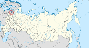
Territory of the federal subject of Saint Petersburg
Satellite image of Saint Petersburg
The area of Saint Petersburg city proper is 605.8 square kilometers (233.9 sq mi). The area of the federal subject is 1,439 square kilometers (556 sq mi), which contains Saint Petersburg proper (consisting of eighty-one municipal okrugs), nine municipal towns – (KolpinoKrasnoye SeloKronstadtLomonosovPavlovskPetergofPushkinSestroretskZelenogorsk) – and twenty-one municipal settlements.
Petersburg is situated on the middle taiga lowlands along the shores of the Neva Bay of the Gulf of Finland, and islands of the river delta. The largest are Vasilyevsky Island (besides the artificial island between Obvodny canal and Fontanka, and Kotlin in the Neva Bay), Petrogradsky, Dekabristov and Krestovsky. The latter together with Yelagin and Kamenny island are covered mostly by parks. The Karelian Isthmus, North of the city, is a popular resort area. In the south Saint Petersburg crosses the Baltic-Ladoga Klint and meets the Izhora Plateau.
The elevation of Saint Petersburg ranges from the sea level to its highest point of 175.9 meters (577 ft) at the Orekhovaya Hill in theDuderhof Heights in the south. Part of the city's territory west of Liteyny Prospekt is no higher than 4 meters (13 ft) above sea level, and has suffered from numerous floods.Floods in Saint Petersburg are triggered by a long wave in the Baltic Sea, caused by meteorological conditions, winds and shallowness of the Neva Bay. The four most disastrous floods occurred in 1824 (421 centimeters or 166 inches above sea level, during which over three hundred buildings were destroyed[35]), 1924 380 centimeters or 150 inches, 1777 321 centimeters or 126 inches, 1955 293 centimeters or 115 inches, and 1975 281 centimeters or 111 inches. To prevent floods, the Saint Petersburg Damhas been constructed.[36]
Since the 18th century the terrain in the city has been raised artificially, at some places by more than 4 meters (13 ft), making mergers of several islands, and changing the hydrology of the city. Besides the Neva and its tributaries, other important rivers of the federal subject of Saint Petersburg are SestraOkhta and Izhora. The largest lake is Sestroretsky Razliv in the north, followed by Lakhtinsky Razliv, Suzdal Lakes and other smaller lakes.
Due to location at ca. 60° N latitude the day length in Petersburg varies across seasons, ranging from 5:53 to 18:50. A period from mid-May to mid-July when twilight may last all night is called the white nights.

Climate[edit]

Under the Köppen climate classification, Saint Petersburg is classified as Dfb, a humid continental climate. Distinct moderating influence of the Baltic Sea cyclones result in warm, humid and short summers and long, moderately cold wet winters. Climate of Saint Petersburg is close to the climate of Helsinki, although colder in winter and warmer in summer because of more eastern location.
The average maximum temperature in July is 23 °C (73 °F), and the average minimum temperature in February is −8.5 °C (16.7 °F); an extreme temperature of 37.1 °C (98.8 °F) occurred during the 2010 Northern Hemisphere summer heat wave. A winter minimum of −35.9 °C (−32.6 °F) was recorded in 1883. The average annual temperature is 5.8 °C (42.4 °F). The Neva River within the city limits usually freezes up in November–December and break-up occurs in April. From December to March there are 118 days average with snow cover, which reaches an average snow depth of 19 cm (7.5 in) by February.[37] The frost-free period in the city lasts on average for about 135 days. Despite St. Petersburg's northern location, its winters are warmer than Moscow's due to Gulf of Finland. The city also has a slightly warmer climate than its suburbs. Weather conditions are quite variable all year round.[38][39]
Average annual precipitation varies across the city, averaging 660 millimeters (26 in) per year and reaching maximum in late summer. Soil moisture is almost always high because of lower evapotranspiration due to the cool climate. Air humidity is 78% on average, and there is on average, 165 overcast days per year.
[hide]Climate data for Saint Petersburg 1981-2010
MonthJanFebMarAprMayJunJulAugSepOctNovDecYear
Record high °C (°F)8.7
(47.7)
10.2
(50.4)
14.9
(58.8)
25.3
(77.5)
32.0
(89.6)
34.6
(94.3)
35.3
(95.5)
37.1
(98.8)
30.4
(86.7)
21.0
(69.8)
12.3
(54.1)
10.9
(51.6)
37.1
(98.8)
Average high °C (°F)−3.0
(26.6)
−3.0
(26.6)
2.0
(35.6)
9.3
(48.7)
16.0
(60.8)
20.0
(68)
23.0
(73.4)
20.8
(69.4)
15.0
(59)
8.6
(47.5)
2.0
(35.6)
−1.5
(29.3)
9.1
(48.4)
Daily mean °C (°F)−5.5
(22.1)
−5.8
(21.6)
−1.3
(29.7)
5.1
(41.2)
11.3
(52.3)
15.7
(60.3)
18.8
(65.8)
16.9
(62.4)
11.6
(52.9)
6.2
(43.2)
0.1
(32.2)
−3.7
(25.3)
5.8
(42.4)
Average low °C (°F)−8.0
(17.6)
−8.5
(16.7)
−4.2
(24.4)
1.5
(34.7)
7.0
(44.6)
11.7
(53.1)
15.0
(59)
13.4
(56.1)
8.8
(47.8)
4.0
(39.2)
−1.8
(28.8)
−6.1
(21)
2.7
(36.9)
Record low °C (°F)−35.9
(−32.6)
−35.2
(−31.4)
−29.9
(−21.8)
−21.8
(−7.2)
−6.6
(20.1)
0.1
(32.2)
4.9
(40.8)
1.3
(34.3)
−3.1
(26.4)
−12.9
(8.8)
−22.2
(−8)
−34.4
(−29.9)
−35.9
(−32.6)
Average precipitation mm (inches)44
(1.73)
33
(1.3)
37
(1.46)
31
(1.22)
46
(1.81)
71
(2.8)
79
(3.11)
83
(3.27)
64
(2.52)
68
(2.68)
55
(2.17)
51
(2.01)
661
(26.02)
Average snowfall cm (inches)18
(7.1)
22
(8.7)
22
(8.7)
29
(11.4)
1
(0.4)
0
(0)
0
(0)
0
(0)
0
(0)
4
(1.6)
14
(5.5)
18
(7.1)
128
(50.5)
Average rainy days9710131618171720201610173
Average snowy days171710300000291775
Average relative humidity (%)86847969656971768083868778
Mean monthly sunshine hours21.753.7124.0180.0260.4276.0266.6213.9129.071.324.012.41,633
Source #1: Pogoda.ru.net[37]
Source #2: HKO (sunshine hours)[40]

Toponymy[edit]

The first and fairly rich chapter of the history of the local toponymy is the story of the own name of the city itself. The name day of Peter I falls on June 29, when the Russian Orthodox Church observes the memory of Saint Apostles Peter and Paul. The consecration of the small wooden church in their names (its construction began simultaneously with the citadel) made them the heavenly patrons of the Peter and Paul Fortress, while St. Peter at the same time became the eponym of the whole city.
An explanation that the origin of "Saint-" in Saint Petersburg is due to Peter the Great's contact with Dutch culture is a common misconception. However this is unlikely as the Dutch Republic adhered to Calvinist Protestantism and had long abandoned and even frowned upon the culture of veneration of saints and the naming of places after them, since the era ofreformation. Moreover "Saint-" in the Dutch language is Sint- and not Sankt-.[41] The sample which czar Peter followed does sound like the names of another European cities: Sankt Goar in Germany, Sankt Michael in Austria and some others, of which the closest to Sankt Petersburg was Sankt Michel in the rival Swedish Empire (now Mikkeli in Finland). Sankt- in these toponyms is merely a Germanized form of LatinSanctus.
While not originally named for Tsar Peter the Great, during World War I the city was renamed from the Germanic "Peterburg" to "Petrograd" in his honour
A 14- to 15-letter-long name, composed of the three roots proved too cumbersome, and a lot of shortened versions appeared in habitual use. The first General Governor of the city Menshikov is maybe also the author of the first nickname of Petersburg which he called Петри (Petri). It took some years until the known Russian spelling of this name finally settled. In 1740s Mikhail Lomonosov uses a derivative of GreekΠετρόπολις (Petropolis,Петрополис) in a russified form Petropol‍ '​ (Петрополь). A combo Piterpol (Питерпол) also appears at this time.[42] In any case, eventually the usage of prefix "Sankt-" ceased except for the formal official documents, where a 3-letter abbreviation "СПб" (SPb) was very widely used as well.
In the 1830s Alexander Pushkin translated the "foreign" city name of "Saint Petersburg" to the more Russian Petrograd in one of his poems. However, it was only on 31 [O.S. 18 August] 1914, after the war with Germany had begun, that tsar Nicholas II renamed the capital to Petrograd. Since the prefix 'Saint' was omitted,[43] this act also changed the eponym and the "patron" of the city, from Apostle Peter to Peter the Great, its founder.
From 1924 to 1991 the city was known as 'Leningrad'. This is a picture of the Saint Petersburg port entrance with an old 'Ленинград' (Leningrad) sign
After the October Revolution, and until the city was renamed Leningrad in January 1924, the name Красный Петроград (Red Petrograd) was often used in newspapers and other prints.
In the referendum on reversing the renaming of Leningrad on June 12, 1991, renaming it to Petrograd was not an option. Only 54.86% of the voters (with a turnout of 65%) supported "Saint Petersburg". This change officially took effect on September 6, 1991.[30] Meanwhile, the oblast whose administrative center is also in Saint Petersburg is still named Leningrad.
Having passed the role of capital to Petersburg, Moscow never relinquished the title of "capital", being called pervoprestolnaya ("first-throned") for 200 years. An equivalent name for Petersburg, the "Northern Capital", has re-entered usage today since several federal institutions were recently moved from Moscow to Saint Petersburg. Solemn descriptive names like "the city of three revolutions" and "the cradle of the October revolution" used in Soviet era are reminders of the pivotal events in national history which occurred here. For their part, poetic names of the city, like the "Venice of the North" and the "Northern Palmyra" emphasize town-planning and architectural features contrasting these parallels to the northern location of this megalopolis.[44] Petropolis is a translation of a city name to Greek, and is also a kind of descriptive name: Πέτρ~ is a Greek root for "stone", so the "city from stone" emphasizes the material which had been forcibly made obligatory for construction from the very first years of the city.[42] (Its official Greek name is Αγία Πετρούπολη.)

Demographics[edit]

Soviet era apartment buildings in Saint Petersburg, July 2010
Saint Petersburg is the second largest city in Russia. As of the 2010 Census, the federal subject's population is 4,879,566 or 3.4% of the total population of Russia;[6] up from 4,661,219 (3.2%) recorded in the 2002 Census,[45] and down from 5,023,506 recorded in the 1989 Census.[46]
Vital statistics for 2012
  • Births: 62 343 (12.6 per 1000)
  • Deaths: 61 910 (12.5 per 1000) [47]
  • Total fertility rate:[48]
2009 - 1.34 | 2010 - 1.38 | 2011 - 1.38 | 2012 - 1.48 | 2013 - 1.48 | 2014 - 1.51(e)
The 2010 Census recorded the ethnic composition as follows:[6] Russian 80.1%, Ukrainian 1.3%, Belarusians 0.8%, Tatar 0.6%, Armenian 0.6%, Jewish 0.5%, Uzbek 0.4%,Tajik 0.3%, Azeri 0.3%, Georgian 0.2%, Moldovan 0.2%, Finns 0.1%, other – 1.3%. The ethnicity of the remaining 13.4% of the inhabitants was not specified.
During the 20th century, the city experienced dramatic population changes. From 2.4 million residents in 1916 its population dropped to less than 740,000 by 1920 during theRussian Revolution of 1917 and Russian Civil War. The minorities of Germans, Poles, Finns, Estonians and Latvians were almost completely transferred from Leningrad during the 1930s.[49] From 1941 to the end of 1943, population dropped from 3 million to less than 600,000, as people died in battles, starved to death during the Siege of Leningrad, or were evacuated. After the siege, some of the evacuees returned, but most influx was due to migration from other parts of the Soviet Union. The city absorbed about 3 million people in the 1950s and grew to over 5 million in the 1980s. From 1991 to 2006 the city's population decreased to 4.6 million, while the suburban population increased due to privatization of land and massive move to suburbs. Based on the 2010 census results the current population is over 4.8 million.[50][51] The birth rate remains lower than the death rate; people over 65 constitute more than twenty percent of the population; and the median age is about 40 years.[52]
People in urban Saint Petersburg live mostly in apartments. Between 1918 and the 1990s, the Soviets nationalised housing and forced residents to share communal apartments (kommunalkas). With 68% living in shared flats in the 1930s, Leningrad was the city in the USSR with the largest number of kommunalkas. Resettling residents of kommunalkas is now on the way out, albeit shared apartments are still not uncommon. As new boroughs were built on the outskirts in the 1950s–1980s, over half a million low income families eventually received free apartments, and about an additional hundred thousand condos were purchased. While economic and social activity is concentrated in the historic city centre, the richest part of Saint Petersburg, most people live in commuter areas. For the first half of 2007, the birth rate was 9.1 per 1000.[53]

No comments:

Post a Comment