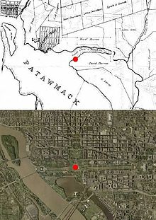
Plan of Washington, D.C.[edit]
According to a notation on Pierre (Peter) Charles L'Enfant's 1791 "Plan of the city intended for the permanent seat of the government of the United States...", Andrew Ellicottmeasured a prime meridian (longitude 0°0') through the future site of the U.S. Capitol.[7][8] (Shortly after L'Enfant prepared this plan, its subject received the name "City of Washington".) Thomas Jefferson, who at the time was serving as the United States Secretary of State, supervised Ellicott's and L'Enfant's activities during the initial planning of the nation's capital city. Jefferson hoped that the United States would become scientifically as well as politically independent from Europe. He therefore desired that the new nation's capital city should contain a new "first meridian".
A prominent geometric feature of L'Enfant's plan was a large right triangle whose hypotenuse was a wide avenue (now part of Pennsylvania Avenue, NW) connecting the "President's house" (now the White House) and the "Congress house" (now the U.S. Capitol building).[9] To complete the triangle, a line projecting due south from the

No comments:
Post a Comment