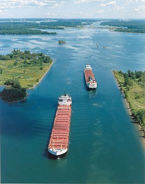
Saint Lawrence Seaway
| Saint Lawrence Seaway | |
|---|---|
 | |
| Specifications | |
| Length | 370 miles (600 km) |
| Maximum boat length | 740 ft 0 in (225.6 m) |
| Maximum boat beam | 78 ft 0 in (23.8 m) |
| Locks | 15 |
| Maximum height above sea level | 570 ft (170 m) |
| Status | Open |
| History | |
| Construction began | 1954 |
| Date of first use | April 25 |
| Date completed | 1959 |
| Geography | |
| Start point | Port Colborne, Ontario |
| End point | Montreal, Quebec |

The Eisenhower Locks in Massena, New York.

Saint Lawrence Seaway separated navigation channel by Montreal.
The Saint Lawrence River portion of the seaway is not a continuous canal; rather, it consists of several stretches of navigable channels within the river, a number of locks, and canals along the banks of the Saint Lawrence River to bypass several rapids and dams. A number of the locks are managed by the St. Lawrence Seaway Management Corporation in Canada, and others in the United States by the Saint Lawrence Seaway Development Corporation; the two bodies together advertise the seaway as part of "Highway H2O".[1] The section of the river from Montreal to the Atlantic is under Canadian jurisdiction, regulated by the offices of Transport Canada in the Port of Quebec.

No comments:
Post a Comment